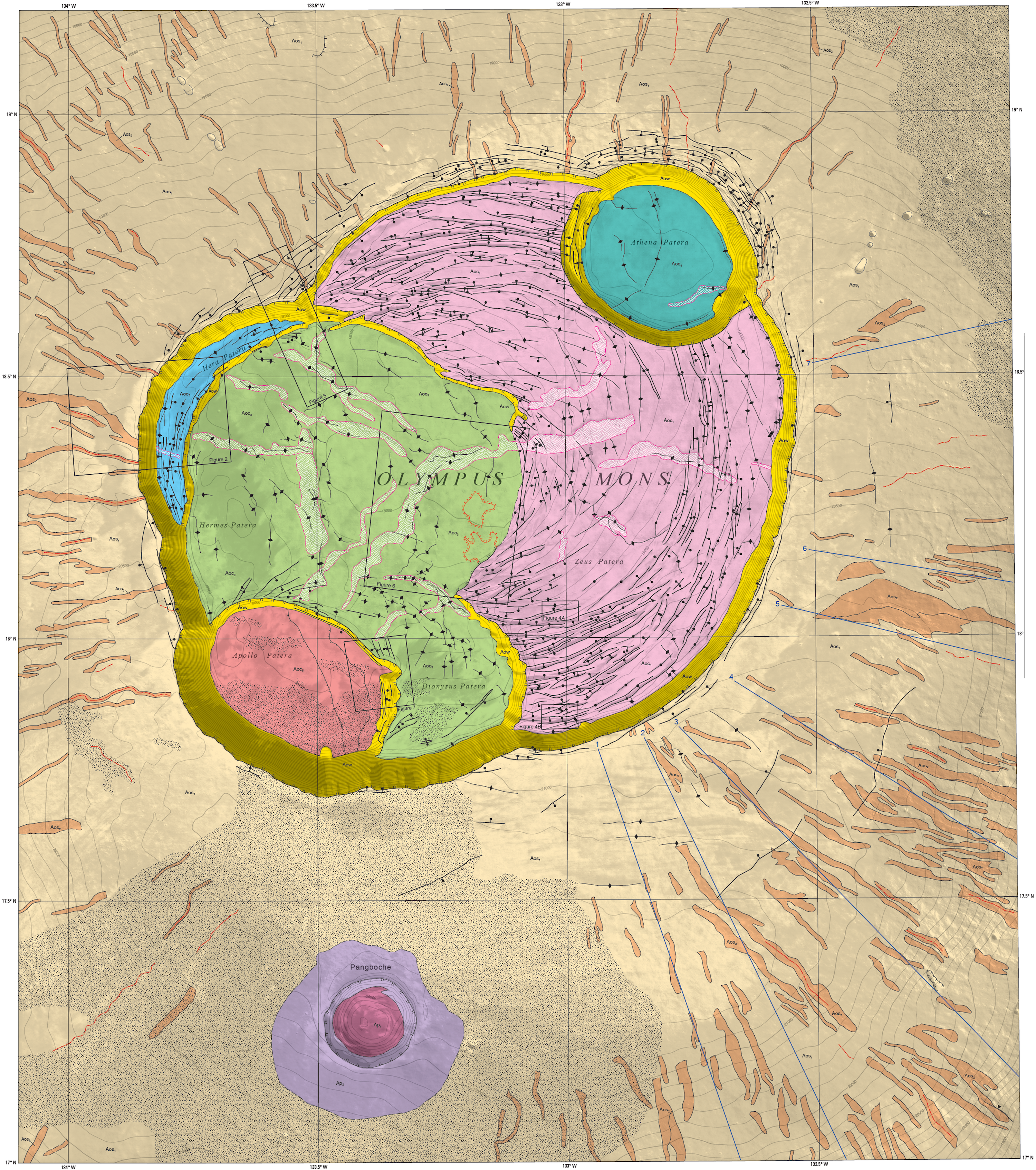
The USGS Astrogeology Science Center has recently released a series of colorful and intricately-detailed maps of Mars. These colorful maps, notes USGS, “provide highly detailed views of the [plantet’s] surface and allow scientists to investigate complex geologic relationships both on and beneath the surface. These types of maps are useful for both planning for and then conducting landed missions.”
The map above lets you see Olympus Mons, the tallest volcano in the solar system, which stands more than twice the height of Mount Everest. The USGS goes on to add: “Map readers can visualize the caldera complex more easily due to the detail that is available at the 1:200,000 scale and the addition of contour lines to the map. The map covers a region that is roughly the size of the Dallas-Ft. Worth metropolitan area and is a detailed look at the volcano’s summit that we have not seen before. This new view of the Olympus Mons caldera complex allows scientists to more easily compare it to similar features on Earth (known as terrestrial analogs) such as Hawaii’s Mauna Loa.”
You can find more Martian maps here.
If you would like to sign up for Open Culture’s free email newsletter, please find it here.
If you would like to support the mission of Open Culture, consider making a donation to our site. It’s hard to rely 100% on ads, and your contributions will help us continue providing the best free cultural and educational materials to learners everywhere. You can contribute through PayPal, Patreon, Venmo (@openculture) and Crypto. Thanks!
Related Content
The Surface of Mars Shown in Stunning 4K Resolution
View and Download Nearly 60,000 Maps from the U.S. Geological Survey (USGS)
Vintage Geological Maps Get Turned Into 3D Topographical Wonders
0 Commentaires